Services
Topographical Survey:
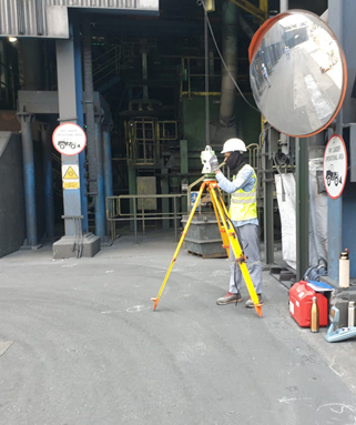
Topographical survey is an essential tool in the field of construction engineering, providing detailed and accurate representation of the area of interest showing all natural and man-made features including the property land and physical boundary details in three dimensions (x y z) on a scaled surveying drawing.
Topographical surveys involve using advanced surveying instruments such as total stations, GPS, and laser scanners to capture precise measurements of the land’s surface.
These instruments collect data on elevation, contours, and the location of natural and artificial features, which are then processed to create detailed topographical maps and 3D models.
We use the latest GNSS technology plus Reflector less, manual and robotic total stations, laser scanners alongside specialized data processing software’s.

Terrestrial Laser Scanning:
Terrestrial scanning survey is a modern and advanced surveying technique that uses ground-based laser scanners to capture detailed and accurate 3D data of physical structures and landscapes.
Terrestrial scanning surveys involve using high-definition laser scanners to emit laser beams towards a target. These beams bounce back to the scanner and the time taken for the light to return is measured.
This data is then used to generate a point cloud, which is processed in faro-scene software to create detailed 3D models and maps in a specialized software. This method allows for capturing millions of data points quickly and accurately.


This method of surveying is used in such applications including:
- Construction Projects: Providing precise as-built documentation for planning and design.
- Infrastructure Monitoring: Inspecting and monitoring the condition of bridges, tunnels, and other critical infrastructure.
- Topographic Mapping: Creating detailed topographic maps for urban planning and development.
- Archaeological Surveys: Documenting historical sites and artifacts with high accuracy.
Microcenter Engineering Services has been the pioneer of using this technology in Bahrain since 2018. And we leverage the latest terrestrial scanning technology where we use both Faro and Leica Laser scanner to offer top-tier survey services. Our experienced team of professionals are committed to deliver precise and reliable data, ensuring the success of your project.


Mobile LiDAR:
Mobile LiDAR (Light Detection and Ranging) is a cutting-edge technology that allows for the rapid and accurate collection of spatial data by using laser scanners mounted on a vehicle. This technology is versatile due to its capability of surveying diverse environments, including urban areas, forests, and industrial sites in a faster pace.
Mobile LiDAR captures precise 3D information about the surrounding environment to generate detailed 2D As-built and 3D models of the environment. The benefit of this technology that it can cover large areas quickly while providing high-resolution data with high accuracy.
Mobile LiDAR is used in a wide range of applications, including:
- Topographic Mapping: Creating detailed maps for planning and design.
- Infrastructure Assessment: Inspecting roads, bridges, machinery and other structures for maintenance and planning.
- Urban Planning: Assisting in city planning and development projects.
At Microcenter Engineering Services, we leverage the latest mobile LiDAR technology Leica Pegasus to provide our clients with supreme survey services to and meet their unique needs.
Scan to BIM
Scan to BIM (Building Information Modeling) is an advanced technology that converts laser scan data into accurate and detailed 3D models. This service bridges the gap between physical structures and digital representations, providing precise as-built models for various applications including:
- Renovation and maintenance projects:Creating accurate as-built models to plan and execute renovations.
- Facility Management: Providing detailed models for ongoing maintenance and management of buildings.
- Quality Control and Quantity Estimation: Ensuring construction accuracy by comparing the BIM model with actual site conditions.
- Heritage Preservation: Documenting and preserving historical buildings.
The execution of Scan to BIM start with laser scanning, the laser scanner captures the required detailed spatial data of a building or site. The laser scanner creates a point cloud, we then process the point cloud and use it a reference in the specialized software, then convert it into a complete BIM model.


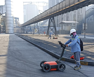
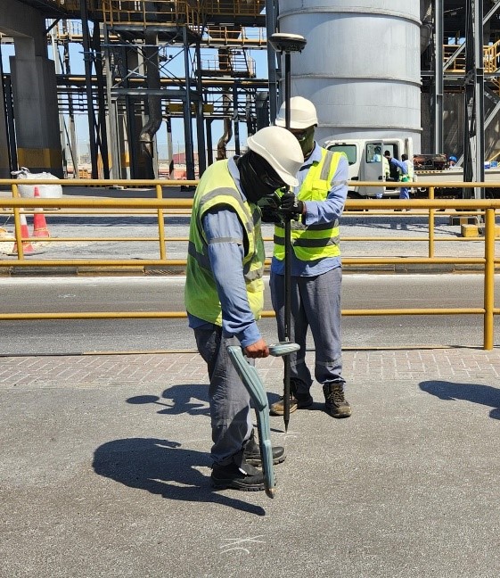
Underground Utility Detection:
Microcenter is the pioneer in executing underground surveying in the Kingdom of Bahrain: we specialize in advanced utility detection using ground penetrating radar technology. This method helps and provide reliable data for identifying and mapping underground utilities and structure, which is essential for efficient and safe project planning and execution
Radio detection uses electromagnetic fields to locate buried metallic utilities such as cables and pipes. By transmitting a signal through these utilities, our equipment can accurately detect their position and depth.
Ground Penetrating Radar (GPR) complements radio detection by using radar pulses to image non-metallic and metallic subsurface features. GPR can detect utilities, voids, and other anomalies, providing a comprehensive view of underground conditions. Together, these technologies ensure thorough and precise underground surveys.
All underground services survey work carried out to current Standard Specification for the Survey of Utilities using Radio detection RD-8000. Services identified on-site are discreetly ‘painted-up’ and surveyed using Total Station/GPS, then is processed using RADAN software and then the drawing is produced in AutoCAD DWG format. The detected utility data can be presented in 2D or 3D superimposed onto a base map.
The Utilities Search Report from Surveys collates and outlines features below the surface such as Electric cables, mains water supplies, oil and gas pipelines, telecommunication wires, sewers, fiber-optic cables, fire protection pipelines, process water pipelines and blow down water pipelines and compressed air main pipelines, buried structures and manholes.
Ground Penetrating Radar (GPR) complements radio detection by using radar pulses to image non-metallic and metallic subsurface features. GPR can detect utilities, voids, and other anomalies, providing a comprehensive view of underground conditions. Together, these technologies ensure thorough and precise underground surveys.
The exact position of the utilities is verified by the use of suitable detecting devices and safe digging practices. We can supplement your initial site information by carrying out an investigation of underground services using Radio detection and Ground Penetrating Radar (GPR) Methods.
It is important to note that Radio detection techniques are unable to detect non-metallic buried services such as plastic water and gas pipes and drainage pipes. To overcome this challenge, we combine the use of Radio detection with Ground Penetrating Radar (GPR). We are using latest GPR with dual frequency antenna from GSSI for underground utilities.
Manhole Investigation Services:
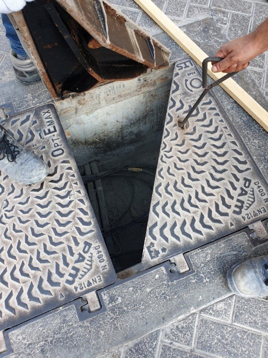
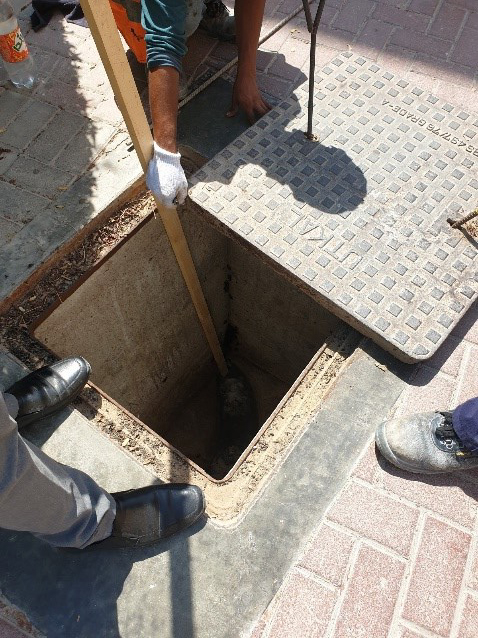
Manhole investigation surveying complements the GPR survey service. At Microcenter, we provide manhole investigation services enhanced with butterfly diagrams along with GPR surveying. This integrated approach offers a detailed assessment of underground utility systems providing the type, condition and state of underground utility that is taken place. Our manhole investigation surveys involve detailed inspections using advanced diagnostic tools.
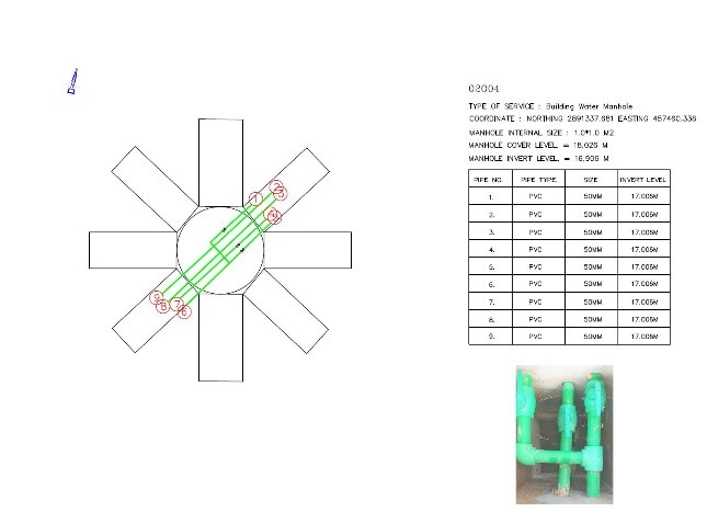
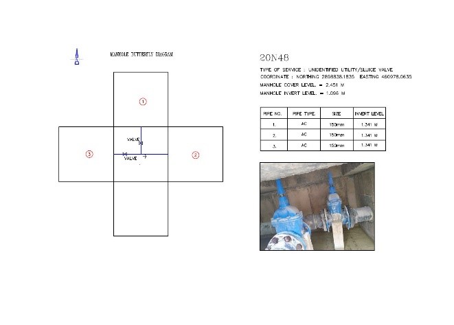
A butterfly diagram is a visual representation that helps in understanding the spatial relationship between manholes and the connected underground utilities. The diagram helps in providing a clear and concise way to map and visualize the underground network which will assist in processing and identifying the underground utilities generating a detailed utility as-built drawing that can aid in better decision-making and planning.
Manhole investigation involves with various applications including:
- Sewer System Assessments: Providing thorough evaluations of sewer lines and manholes.
- Infrastructure Development: Assisting in the design and planning of new projects by offering accurate subsurface data.
- Utility Mapping: Creating detailed maps of underground utilities for maintenance and development.
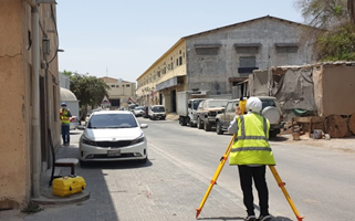
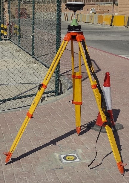
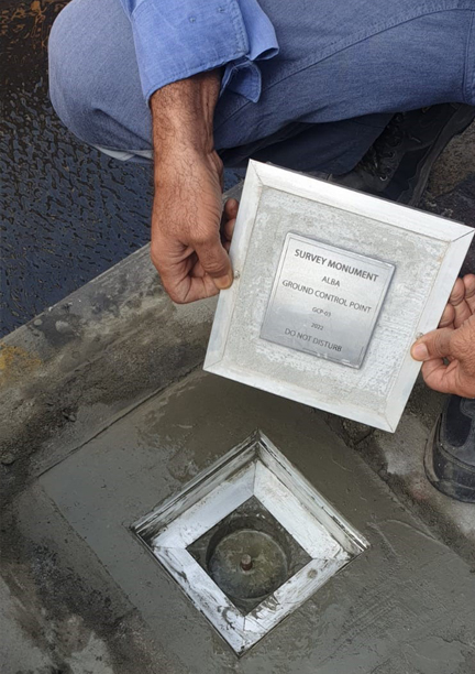
Control Points Surveying Services:
Establishing control points is a critical component for a surveying project, providing a precise reference framework for accurate mapping and construction. Our control points surveying services guarantees that your projects start with a solid foundation.
Our control points surveying service involves the precise placement and documentation of reference points across a project site. We establish a network of fixed points that serve as the foundation for all subsequent surveying and construction activities.
Establishing control points is essential for:
- Construction Projects: Providing a reference for accurate layout and alignment of structures.
- Mapping and GIS: Ensuring the precision of geographic information systems and large-scale mapping projects.
- Infrastructure Development: Supporting the construction and maintenance of roads, bridges, and utilities.
- Land Development: Assisting in the land redevelopment and preparation of detailed site plans.
We use the latest GPS and total station technology such as Leica GS16 and GS18 and Leica Flexline TS06 PLUS when establishing a control network on site. Permanent reference network (PRN) in Bahrain provides the fundamental infrastructure for development of a huge variety of GNSS applications and whole of the Bahrain is supported with this service. We also use space-based GNSS correction (Omni Star) in the areas where RTK is not available i.e. in some regions of Saudi Arabia.
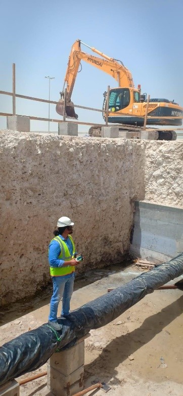
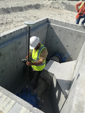
Live and open trench utility (Electrical and Water) Survey:
Microcenter is the pioneer in surveying live and open trench utility surveys for electrical and water utilities. Our detailed surveys ensure accurate mapping and documentation of underground utilities, important for safe and efficient infrastructure development.
Live and open trench utility surveys involve the recording and mapping of underground utilities while they are exposed during construction or maintenance activities. Our team uses advanced surveying techniques to accurately record the location, depth, and condition of electrical and water utilities. This data is vital for avoiding utility conflicts, planning future works, and ensuring the safety of ongoing projects.
The importance of capturing and maintaining high quality, accurate and consistent utility network records in the Enterprise GIS environment that will enable better network-planning and improved customer support and services. Physically verifying, evaluating, measuring and recording the location coordinates for a particular utility networks assets while collecting attributes such as size, material, type, condition, configuration and so forth for the specific utility and assets under construction.
Keeping Enterprise GIS updated ensures that GIS always stays current and accurate through regular data updates. The following services can be carried out with high special accuracy and network connectivity:
- New house connections -Electricity and water networks
- Emergency services that involve alteration in Electrical and water network route
- LV reinforcement projects
- 11 KV reinforcement projects
- 33\66\220 KV transmission projects
- Substation, transformer up-gradation
- Diversion of cables and pipes
- Water distribution network's construction projects
- Other Network reinforcement
- Irrigation and effluent water network