MicroCenter Special Projects
MicroCenter Group is a leading IT technology expert, successfully operating over 30 years in Kingdom of Bahrain. It specializes in Geospatial-GIS consulting & software Solutions, Utility survey & Geo data, ICT business Solutions, Software integration, ERP & Smart card Solutions and Geospatial & ICT training.
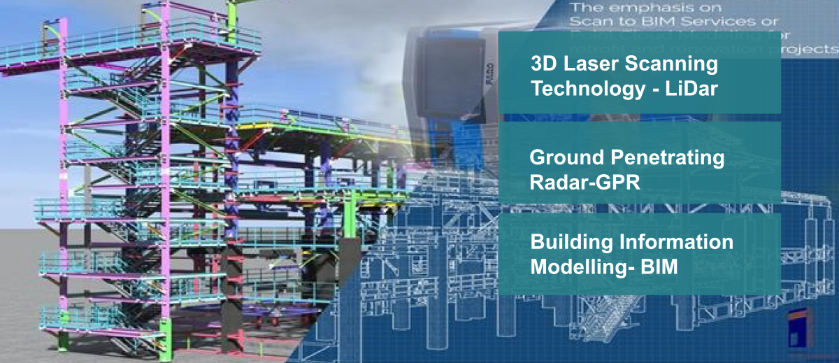
In recent years, MicroCenter enhanced its portfolio of capabilities into three (03) key Technology areas namely 3D Laser Scanning Technology – LiDar , Ground Penetrating Radar and BIM modelling.
Professionals from the Architecture, Engineering and Construction-AEC, Ministries and Government, Industrial facilities & Businesses are constantly striving to improve precision in data quality, greater efficiency in surveying cum data collection techniques and Building Information Modeling-BIM process.
There ultimate aim is to save time and cost, increase speed & efficiency at works, mitigate risk, and improves safety at project, they execute.
One single and emerging technology impacting all these areas is 3D laser scanning-LIDAR, which is transforming the way surveying, engineering & construction project documentation, Mapping, As-built & Building Information Modelling-BIM.
3D Laser Scanning Technology –LiDar
MicroCenter is focused on efficiency and quality in all that we do. The collection of data has evolved over recent years. Field information which was once collected by a team of engineers with clip boards and measuring tapes, is now replaced by high-definition digital imaging (scanning) instruments run by a single field engineer. 3D laser scanning is our preferred method of documenting field information, as it offers several advantages over traditional methods of collecting data.
Ground Penetrating Radar – GPR
Ground-penetrating radar is a versatile geophysical method. It can be used in the geotechnical field in concrete inspection and analysis, as well as in a range of other fields such as in environmental, archeological and transportation projects.
Building Information modelling-BIM
BIM is one of our core expertise. Our BIM offerings are for a variety of projects. We use two platforms, one Laser Scan to BIM and second 2D drawing to BIM to develop Building information model for the existing, Conceptual, under construction and post construction projects. The output of the process will be the BIM in 3D (width, height, and depth) with inclusion of time, cost & as-built operations (4D, 5D, 6D).